 Directions to Alapocas Run Park, Alapocas Loop trailhead
:
(39°46'25.42"N 75°33'57.18"W) From the intersection of Route 202 (Concord Pike) & Route 141 in Wilmington, take 141 west 1.3 miles to Alapocas Drive. Turn left (S) on Alapocas, pass the DuPont Experimental Station entrance, and take the next right (SW), a total of only 0.2 mile from Route 141. In another 0.2 mile, park in the baseball field parking lot. The Alapocas Loop trail leads east from the east corner of the lot.
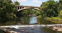
Directions to Brandywine Park:
By foot, the park is easily reached from downtown via the North Market Street bridge over the Brandywine River. One can follow the streamside path a mile or more north up the river's west bank. For motorists, the most convenient parking is near the Brandywine Zoo (39°45'16.71"N 75°32'57.87"W). From I-95 in Wilmington, take Route 52 North (Pennsylvania Avenue) 0.1 mile and turn right (NE) onto North Van Buren Street. After 0.4 mile, turn left at the bottom of the hill (S) onto North Park Drive. The zoo entrance is to the left. A nice birding walk may be had by crossing the river by foot on North Van Buren Street and following the foot path north a half mile or so up the west bank of the river.
Other Birding Sites in the Piedmont Hills & Valleys Region:
- White Clay Creek State Park
- Ashland Nature Center
- Brandywine Creek State Park
- Wilmington State Parks